
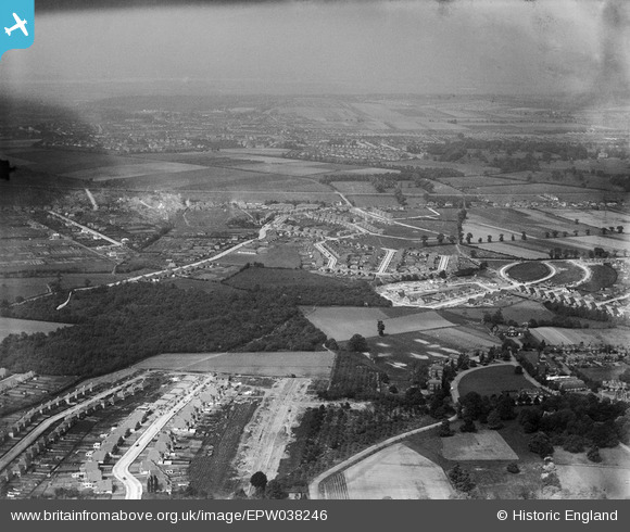
EPW038246 ENGLAND (1932). New housing around Christians Wood and environs, Blackfen, from the south-west, 1932
© Copyright OpenStreetMap contributors and licensed by the OpenStreetMap Foundation. 2026. Cartography is licensed as CC BY-SA.
Nearby Images (3)
EPW038246

EPW038247

EPW038249

Details
| Title | [EPW038246] New housing around Christians Wood and environs, Blackfen, from the south-west, 1932 |
| Reference | EPW038246 |
| Date | June-1932 |
| Link | |
| Place name | BLACKFEN |
| Parish | |
| District | |
| Country | ENGLAND |
| Easting / Northing | 545799, 173566 |
| Longitude / Latitude | 0.098099498587291, 51.441805571595 |
| National Grid Reference | TQ458736 |
Pins

Barney |
Saturday 7th of September 2019 08:53:16 AM | |
|
Barney |
Saturday 7th of September 2019 08:52:43 AM | |
|
Barney |
Saturday 7th of September 2019 08:17:02 AM | |
|
Barney |
Saturday 7th of September 2019 08:11:59 AM | |
|
Barney |
Saturday 7th of September 2019 08:11:20 AM | |
|
Barney |
Saturday 7th of September 2019 08:10:49 AM | |
|
Barney |
Saturday 7th of September 2019 08:10:05 AM | |
|
Barney |
Saturday 7th of September 2019 08:09:39 AM | |
|
Barney |
Saturday 7th of September 2019 08:08:26 AM | |
|
Barney |
Saturday 7th of September 2019 08:08:00 AM | |
|
Barney |
Saturday 7th of September 2019 08:07:34 AM |