
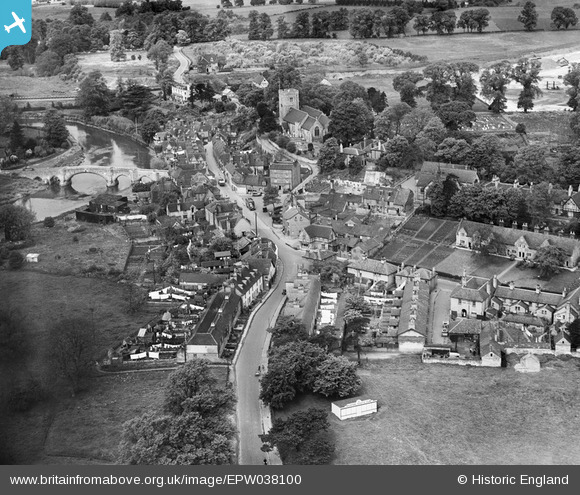
EPW038100 ENGLAND (1932). Forstall Road and the High Street, Aylesford, 1932
© Copyright OpenStreetMap contributors and licensed by the OpenStreetMap Foundation. 2026. Cartography is licensed as CC BY-SA.
Nearby Images (12)
EPW038100

EPW032114

EPW038096

EAW048694

EAW048695

EPW038104

EPW038105

EAW048696

EPW032112

EPW032111

EPW032113

EPW038101

Details
| Title | [EPW038100] Forstall Road and the High Street, Aylesford, 1932 |
| Reference | EPW038100 |
| Date | May-1932 |
| Link | |
| Place name | AYLESFORD |
| Parish | AYLESFORD |
| District | |
| Country | ENGLAND |
| Easting / Northing | 573060, 158983 |
| Longitude / Latitude | 0.48292777381745, 51.303115474402 |
| National Grid Reference | TQ731590 |
Pins
Be the first to add a comment to this image!