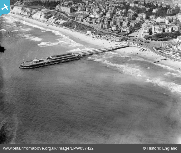
EPW037422 ENGLAND (1932). Bournemouth Pier and West Cliff, Bournemouth, 1932
© Copyright OpenStreetMap contributors and licensed by the OpenStreetMap Foundation. 2026. Cartography is licensed as CC BY-SA.
Nearby Images (25)
EPW037422

EPW041047

EPW041046

EPW000252

EPR000661

EPW013551

EAW050052

EPW061510

EAW050053

EPW000253

EPW000261

EPW037418

EAW034624

EAW049056

EAW018154

EPW013553

EPW041041

EPW018167

EPW013560

EPW018164

EPW013552

EPW000266

EAW035603

EAW002993

EAW034625

Details
| Title | [EPW037422] Bournemouth Pier and West Cliff, Bournemouth, 1932 |
| Reference | EPW037422 |
| Date | April-1932 |
| Link | |
| Place name | BOURNEMOUTH |
| Parish | |
| District | |
| Country | ENGLAND |
| Easting / Northing | 409000, 90572 |
| Longitude / Latitude | -1.8725088236391, 50.714134543464 |
| National Grid Reference | SZ090906 |