
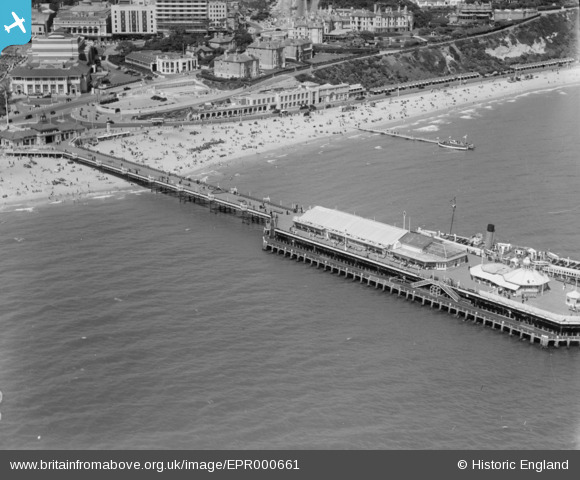
EPR000661 ENGLAND (1935). The pier, Bournemouth, 1935
© Copyright OpenStreetMap contributors and licensed by the OpenStreetMap Foundation. 2026. Cartography is licensed as CC BY-SA.
Nearby Images (25)
EPR000661

EPW013551

EPW000252

EAW050053

EPW041047

EPW000261

EAW049056

EPW041046

EPW037422

EPW000253

EPW037418

EPW018164

EPW018167

EAW034624

EPW061510

EAW018154

EPW013553

EAW050052

EPW013560

EPW018155

EPW000266

EPW013552

EAW002993

EPW041041

EAW035603

Details
| Title | [EPR000661] The pier, Bournemouth, 1935 |
| Reference | EPR000661 |
| Date | 26-June-1935 |
| Link | |
| Place name | BOURNEMOUTH |
| Parish | |
| District | |
| Country | ENGLAND |
| Easting / Northing | 408915, 90556 |
| Longitude / Latitude | -1.8737132904978, 50.713991954705 |
| National Grid Reference | SZ089906 |
Pins

Louis |
Wednesday 12th of November 2014 07:22:37 PM |
User Comment Contributions

View from the pier, 07/11/2014 |

Class31 |
Saturday 8th of November 2014 09:30:23 PM |