
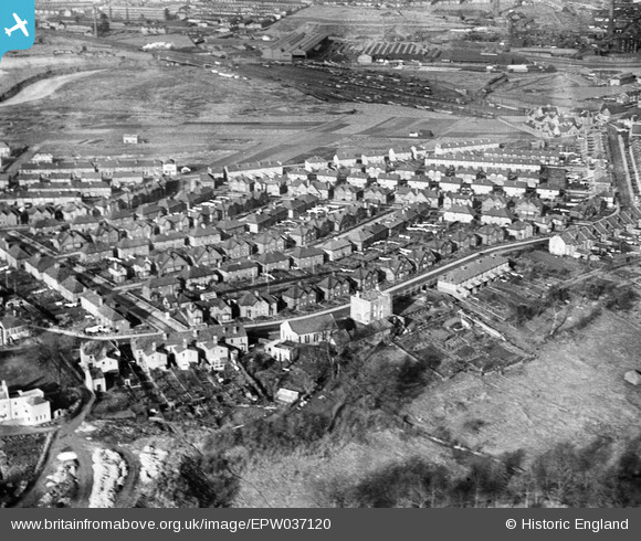
EPW037120 ENGLAND (1931). Housing surrounding Wick Road and Sutton Avenue, Brislington, from the south, 1931
© Copyright OpenStreetMap contributors and licensed by the OpenStreetMap Foundation. 2026. Cartography is licensed as CC BY-SA.
Nearby Images (11)
EPW037120

EPW037116

EPW037115

EPW037117

EPW037114

EPW037125

EPW037118

EPW037122

EPW037119

EPW037123

EPW037124

Details
| Title | [EPW037120] Housing surrounding Wick Road and Sutton Avenue, Brislington, from the south, 1931 |
| Reference | EPW037120 |
| Date | October-1931 |
| Link | |
| Place name | BRISLINGTON |
| Parish | |
| District | |
| Country | ENGLAND |
| Easting / Northing | 361873, 171785 |
| Longitude / Latitude | -2.5486534042375, 51.443281591428 |
| National Grid Reference | ST619718 |
