
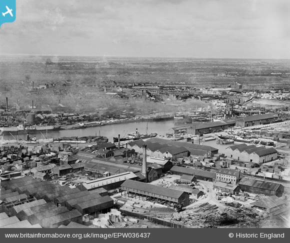
EPW036437 ENGLAND (1931). The London and North Eastern Railway Dock Yard, Victoria Dock and environs, Kingston upon Hull, from the south-west, 1931
© Copyright OpenStreetMap contributors and licensed by the OpenStreetMap Foundation. 2026. Cartography is licensed as CC BY-SA.
Nearby Images (10)
EPW036437

EPW062612

EPW062611

EPW036426

EPW062614

EPW062613

EPW062615

EPW012702

EAW046143

EPW036528

Details
| Title | [EPW036437] The London and North Eastern Railway Dock Yard, Victoria Dock and environs, Kingston upon Hull, from the south-west, 1931 |
| Reference | EPW036437 |
| Date | August-1931 |
| Link | |
| Place name | KINGSTON UPON HULL |
| Parish | |
| District | |
| Country | ENGLAND |
| Easting / Northing | 510800, 428508 |
| Longitude / Latitude | -0.31985404759404, 53.740941400044 |
| National Grid Reference | TA108285 |
Pins

John Wass |
Wednesday 20th of August 2014 08:11:09 PM | |
|
John Wass |
Wednesday 20th of August 2014 08:11:08 PM | |
|
MB |
Tuesday 25th of December 2012 10:51:09 AM | |
|
MB |
Tuesday 25th of December 2012 10:50:03 AM | |
|
MB |
Tuesday 25th of December 2012 10:47:44 AM |