
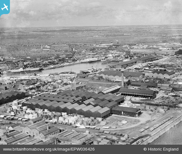
EPW036426 ENGLAND (1931). The London and North Eastern Railway Dock Yard, Victoria Dock and environs, Kingston upon Hull, from the south-west, 1931
© Copyright OpenStreetMap contributors and licensed by the OpenStreetMap Foundation. 2026. Cartography is licensed as CC BY-SA.
Nearby Images (9)
EPW036426

EPW062612

EPW062615

EPW062611

EPW036437

EPW062614

EPW062613

EPW012702

EPW036528

Details
| Title | [EPW036426] The London and North Eastern Railway Dock Yard, Victoria Dock and environs, Kingston upon Hull, from the south-west, 1931 |
| Reference | EPW036426 |
| Date | August-1931 |
| Link | |
| Place name | KINGSTON UPON HULL |
| Parish | |
| District | |
| Country | ENGLAND |
| Easting / Northing | 510682, 428424 |
| Longitude / Latitude | -0.32167260765297, 53.740211704078 |
| National Grid Reference | TA107284 |
Pins
Be the first to add a comment to this image!