
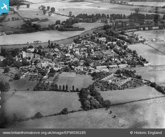
EPW036185 ENGLAND (1931). The village, Bray, from the south-west, 1931
© Copyright OpenStreetMap contributors and licensed by the OpenStreetMap Foundation. 2026. Cartography is licensed as CC BY-SA.
Nearby Images (7)
EPW036185

EAW003808

EPW036183

EAW056568

EPW022615

EPW036186

EPW022614

Details
| Title | [EPW036185] The village, Bray, from the south-west, 1931 |
| Reference | EPW036185 |
| Date | August-1931 |
| Link | |
| Place name | BRAY |
| Parish | BRAY |
| District | |
| Country | ENGLAND |
| Easting / Northing | 490098, 179377 |
| Longitude / Latitude | -0.70168610856288, 51.505651557941 |
| National Grid Reference | SU901794 |
Pins
Be the first to add a comment to this image!