
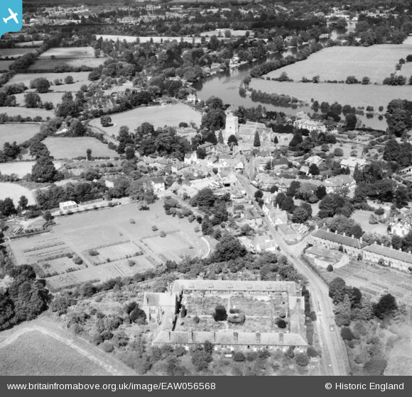
EAW056568 ENGLAND (1954). The village, Bray, 1954
© Copyright OpenStreetMap contributors and licensed by the OpenStreetMap Foundation. 2026. Cartography is licensed as CC BY-SA.
Nearby Images (11)
EAW056568

EPW022615

EPW036181

EPW022614

EAW003808

EPW036185

EPW036186

EPW036183

EPW036182

EPW022616

EAW003807

Details
| Title | [EAW056568] The village, Bray, 1954 |
| Reference | EAW056568 |
| Date | 7-September-1954 |
| Link | |
| Place name | BRAY |
| Parish | BRAY |
| District | |
| Country | ENGLAND |
| Easting / Northing | 490171, 179548 |
| Longitude / Latitude | -0.70059073381129, 51.507177233127 |
| National Grid Reference | SU902795 |
