
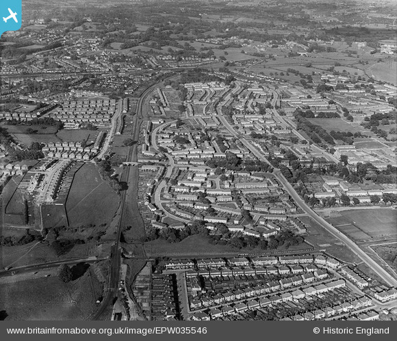
EPW035546 ENGLAND (1931). The Northern Line heading east, Deansbrook Road and environs, Burnt Oak, 1931
© Copyright OpenStreetMap contributors and licensed by the OpenStreetMap Foundation. 2026. Cartography is licensed as CC BY-SA.
Nearby Images (6)
EPW035546

EAW033377

EPW034560

EAW033376

EPW034562

EPW034557

Details
| Title | [EPW035546] The Northern Line heading east, Deansbrook Road and environs, Burnt Oak, 1931 |
| Reference | EPW035546 |
| Date | June-1931 |
| Link | |
| Place name | BURNT OAK |
| Parish | |
| District | |
| Country | ENGLAND |
| Easting / Northing | 520219, 191610 |
| Longitude / Latitude | -0.2636458235213, 51.609999813721 |
| National Grid Reference | TQ202916 |
Pins

Graham Nunn |
Friday 12th of April 2019 11:19:49 PM | |
|
Glywri |
Sunday 15th of January 2017 08:44:05 PM | |
|
Glywri |
Sunday 15th of January 2017 08:42:24 PM | |
|
Glywri |
Sunday 15th of January 2017 08:41:12 PM | |
|
Glywri |
Sunday 15th of January 2017 08:39:40 PM | |
|
Glywri |
Sunday 15th of January 2017 08:39:20 PM | |
|
Glywri |
Sunday 15th of January 2017 08:38:50 PM | |
|
Airwick |
Saturday 26th of March 2016 09:21:08 PM | |
|
snapper31 |
Saturday 1st of June 2013 06:37:42 PM | |
|
snapper31 |
Saturday 1st of June 2013 06:35:06 PM | |
Actually Abbots Road |
Glywri |
Sunday 15th of January 2017 08:37:53 PM |
|
snapper31 |
Saturday 1st of June 2013 06:29:41 PM | |
|
snapper31 |
Saturday 1st of June 2013 06:28:09 PM | |
|
colsouth111 |
Wednesday 2nd of January 2013 10:02:08 PM | |
|
colsouth111 |
Wednesday 2nd of January 2013 10:00:02 PM |