
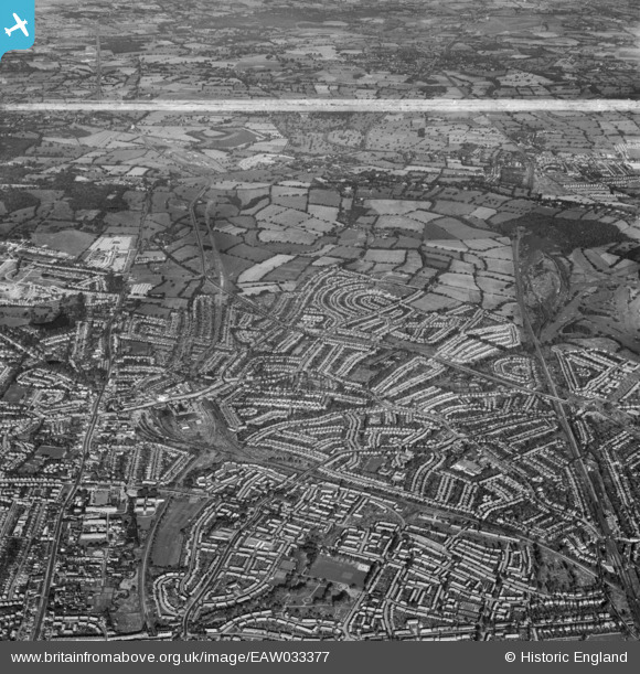
EAW033377 ENGLAND (1950). Burnt Oak, Edgware and environs, Edgware, from the south-east, 1950. This image was marked by Aerofilms Ltd for photo editing.
© Copyright OpenStreetMap contributors and licensed by the OpenStreetMap Foundation. 2026. Cartography is licensed as CC BY-SA.
Nearby Images (6)
EAW033377

EPW035546

EPW034560

EAW033376

EPW034562

EPW034557

Details
| Title | [EAW033377] Burnt Oak, Edgware and environs, Edgware, from the south-east, 1950. This image was marked by Aerofilms Ltd for photo editing. |
| Reference | EAW033377 |
| Date | 10-October-1950 |
| Link | |
| Place name | EDGWARE |
| Parish | |
| District | |
| Country | ENGLAND |
| Easting / Northing | 520266, 191671 |
| Longitude / Latitude | -0.26294639414851, 51.61053805453 |
| National Grid Reference | TQ203917 |


