
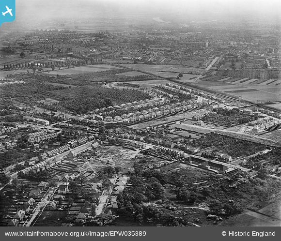
EPW035389 ENGLAND (1931). Housing at Whitton, the Nelson Road Primary School and environs, Whitton, from the north-west, 1931
© Copyright OpenStreetMap contributors and licensed by the OpenStreetMap Foundation. 2026. Cartography is licensed as CC BY-SA.
Nearby Images (2)
EPW035389

EPW035387

Details
| Title | [EPW035389] Housing at Whitton, the Nelson Road Primary School and environs, Whitton, from the north-west, 1931 |
| Reference | EPW035389 |
| Date | 27-May-1931 |
| Link | |
| Place name | WHITTON |
| Parish | |
| District | |
| Country | ENGLAND |
| Easting / Northing | 514060, 173992 |
| Longitude / Latitude | -0.35826909430274, 51.452917702323 |
| National Grid Reference | TQ141740 |
Pins

srbuild&design |
Thursday 10th of January 2013 11:10:53 AM | |
|
srbuild&design |
Thursday 10th of January 2013 11:09:57 AM |