
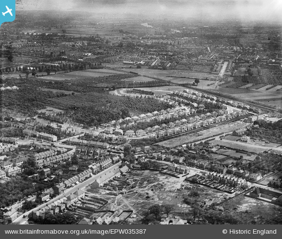
EPW035387 ENGLAND (1931). Housing at Whitton and environs, Whitton, from the north-west, 1931
© Copyright OpenStreetMap contributors and licensed by the OpenStreetMap Foundation. 2026. Cartography is licensed as CC BY-SA.
Nearby Images (2)
EPW035387

EPW035389

Details
| Title | [EPW035387] Housing at Whitton and environs, Whitton, from the north-west, 1931 |
| Reference | EPW035387 |
| Date | 27-May-1931 |
| Link | |
| Place name | WHITTON |
| Parish | |
| District | |
| Country | ENGLAND |
| Easting / Northing | 514163, 173981 |
| Longitude / Latitude | -0.35679076222634, 51.452798061304 |
| National Grid Reference | TQ142740 |
Pins

Isleworth1961 |
Monday 11th of February 2013 04:00:17 PM | |
|
Isleworth1961 |
Monday 11th of February 2013 03:57:11 PM | |
|
srbuild&design |
Thursday 10th of January 2013 11:06:34 AM | |
These are shops, I've placed a new pin for the Prince Albert pub. |
Isleworth1961 |
Monday 11th of February 2013 03:58:40 PM |