
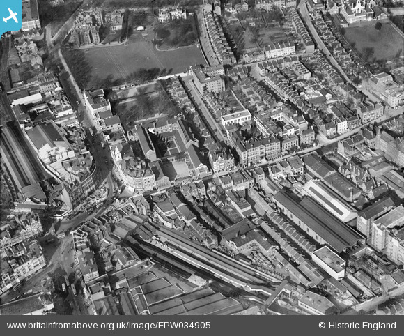
EPW034905 ENGLAND (1931). Hammersmith Railway Station, the Convent and School of the Sacred Heart, the West London Hospital and environs, Hammersmith, 1931
© Copyright OpenStreetMap contributors and licensed by the OpenStreetMap Foundation. 2026. Cartography is licensed as CC BY-SA.
Nearby Images (13)
EPW034905

EPW034909

EPW034906

EPW034910

EPW034904

EPW034903

EPW034908

EPW034907

EPW034911

EPW025119

EPR000469

EPW057072

EPR000465

Details
| Title | [EPW034905] Hammersmith Railway Station, the Convent and School of the Sacred Heart, the West London Hospital and environs, Hammersmith, 1931 |
| Reference | EPW034905 |
| Date | March-1931 |
| Link | |
| Place name | HAMMERSMITH |
| Parish | |
| District | |
| Country | ENGLAND |
| Easting / Northing | 523475, 178645 |
| Longitude / Latitude | -0.22119479398696, 51.492764587667 |
| National Grid Reference | TQ235786 |
Pins

Robin |
Tuesday 10th of December 2024 05:47:23 PM | |
|
Leslie B |
Wednesday 3rd of August 2022 10:33:16 PM | |
|
Leslie B |
Wednesday 3rd of August 2022 10:26:20 PM | |
|
Leslie B |
Wednesday 3rd of August 2022 10:23:12 PM | |
|
Leslie B |
Wednesday 3rd of August 2022 10:22:16 PM | |
|
bondi |
Saturday 7th of November 2015 10:35:39 AM | |
|
The Laird |
Sunday 16th of August 2015 10:59:26 AM | |
|
John Wass |
Sunday 27th of July 2014 12:39:08 PM | |
|
FermePark |
Thursday 21st of March 2013 09:35:05 PM |