
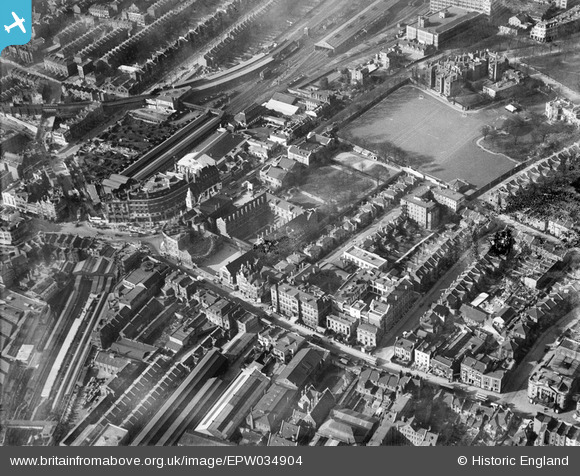
EPW034904 ENGLAND (1931). Hammersmith Road, the West London Hospital and environs, Hammersmith, 1931
© Copyright OpenStreetMap contributors and licensed by the OpenStreetMap Foundation. 2026. Cartography is licensed as CC BY-SA.
Nearby Images (13)
EPW034904

EPW034907

EPW034906

EPW034910

EPW034911

EPW034903

EPW034909

EPW034905

EPW034908

EPW025119

EPR000469

EPW057072

EPW059943

Details
| Title | [EPW034904] Hammersmith Road, the West London Hospital and environs, Hammersmith, 1931 |
| Reference | EPW034904 |
| Date | March-1931 |
| Link | |
| Place name | HAMMERSMITH |
| Parish | |
| District | |
| Country | ENGLAND |
| Easting / Northing | 523474, 178696 |
| Longitude / Latitude | -0.22119134662705, 51.493223203283 |
| National Grid Reference | TQ235787 |
Pins

Claire |
Thursday 27th of August 2020 01:28:21 PM | |
|
The Laird |
Sunday 14th of June 2015 01:24:18 PM | |
|
The Laird |
Sunday 14th of June 2015 01:23:35 PM | |
|
The Laird |
Sunday 14th of June 2015 01:21:54 PM | |
|
The Laird |
Sunday 14th of June 2015 01:21:25 PM | |

Class31 |
Tuesday 9th of September 2014 01:05:57 PM | |
|
Class31 |
Tuesday 9th of September 2014 01:05:11 PM | |
|
Ben Walsh |
Sunday 9th of June 2013 02:08:03 PM | |
|
FermePark |
Thursday 21st of March 2013 09:33:48 PM |


User Comment Contributions

Hammersmith Broadway, 08/09/2014 |
Class31 |
Tuesday 9th of September 2014 01:06:20 PM |