
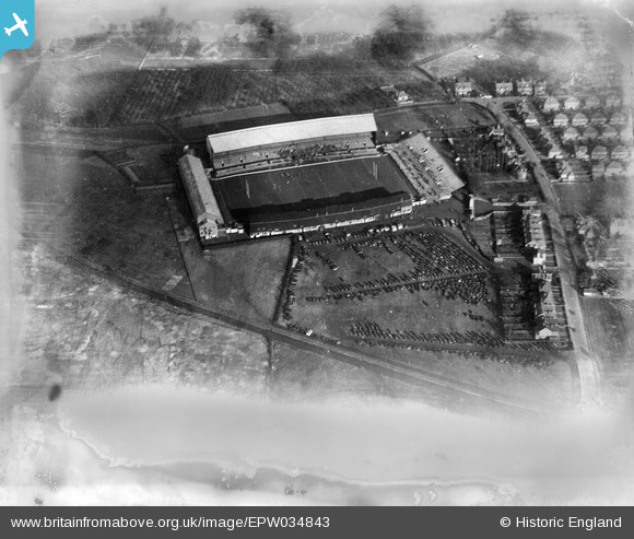
EPW034843 ENGLAND (1931). Twickenham Rugby Football Ground, Twickenham, 1931. This image has been produced from a damaged negative.
© Copyright OpenStreetMap contributors and licensed by the OpenStreetMap Foundation. 2026. Cartography is licensed as CC BY-SA.
Nearby Images (22)
EPW034843

EPW049449

EPW049451

EPW025845

EPR000638

EPW049446

EPW049448

EPW049452

EPW023249

EPW049450

EPW049453

EPW025844

EPW025839

EPW025842

EPW025843

EPW017385

EPW025840

EPW025841

EPW022945

EPW049454

EPW049455

EPW049447

Details
| Title | [EPW034843] Twickenham Rugby Football Ground, Twickenham, 1931. This image has been produced from a damaged negative. |
| Reference | EPW034843 |
| Date | 1931 |
| Link | |
| Place name | TWICKENHAM |
| Parish | |
| District | |
| Country | ENGLAND |
| Easting / Northing | 515220, 174255 |
| Longitude / Latitude | -0.34149434560176, 51.455046836909 |
| National Grid Reference | TQ152743 |
Pins
Be the first to add a comment to this image!