
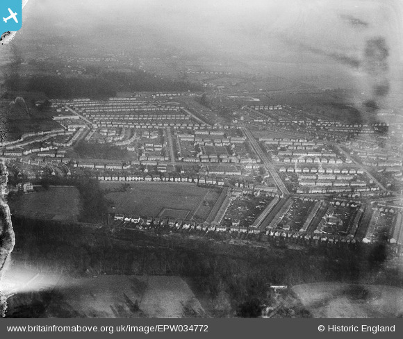
EPW034772 ENGLAND (1931). Residential area around Longspring and Fuller Road, North Watford, from the south-west, 1931
© Copyright OpenStreetMap contributors and licensed by the OpenStreetMap Foundation. 2026. Cartography is licensed as CC BY-SA.
Nearby Images (3)
EPW034772

EPW034775

EPW034776

Details
| Title | [EPW034772] Residential area around Longspring and Fuller Road, North Watford, from the south-west, 1931 |
| Reference | EPW034772 |
| Date | January-1931 |
| Link | |
| Place name | NORTH WATFORD |
| Parish | |
| District | |
| Country | ENGLAND |
| Easting / Northing | 510355, 198503 |
| Longitude / Latitude | -0.40387756238319, 51.67397987528 |
| National Grid Reference | TQ104985 |
Pins

Paul |
Wednesday 10th of January 2024 03:38:32 PM |