
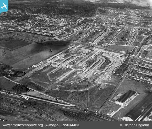
EPW034463 ENGLAND (1930). Housing under construction at Pennine Drive and environs, Golders Green, 1930
© Copyright OpenStreetMap contributors and licensed by the OpenStreetMap Foundation. 2025. Cartography is licensed as CC BY-SA.
Nearby Images (11)
EPW034463

EPW034462

EPW034470

EPW034469

EPW038718

EPW034464

EPW034466

EPW034467

EPW034468

EPW034471

EPW052704

Details
| Title | [EPW034463] Housing under construction at Pennine Drive and environs, Golders Green, 1930 |
| Reference | EPW034463 |
| Date | August-1930 |
| Link | |
| Place name | GOLDERS GREEN |
| Parish | |
| District | |
| Country | ENGLAND |
| Easting / Northing | 524019, 186882 |
| Longitude / Latitude | -0.21046074301397, 51.566680300349 |
| National Grid Reference | TQ240869 |
Pins
Be the first to add a comment to this image!