
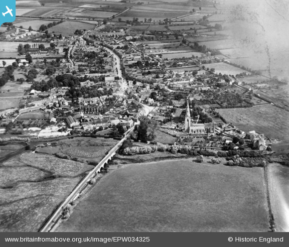
EPW034325 ENGLAND (1930). The town, Olney, from the south, 1930. This image has been produced from a damaged copy-negative.
© Copyright OpenStreetMap contributors and licensed by the OpenStreetMap Foundation. 2026. Cartography is licensed as CC BY-SA.
Nearby Images (8)
EPW034325

EPW034324

EPW028996

EPW034449

EAW034575

EPW028994

EAW034574

EAW034576

Details
| Title | [EPW034325] The town, Olney, from the south, 1930. This image has been produced from a damaged copy-negative. |
| Reference | EPW034325 |
| Date | July-1930 |
| Link | |
| Place name | OLNEY |
| Parish | OLNEY |
| District | |
| Country | ENGLAND |
| Easting / Northing | 488909, 250918 |
| Longitude / Latitude | -0.70043453689128, 52.148973657368 |
| National Grid Reference | SP889509 |
