
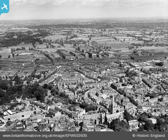
EPW033935 ENGLAND (1930). The town centre, Rugby, from the south-west, 1930
© Copyright OpenStreetMap contributors and licensed by the OpenStreetMap Foundation. 2026. Cartography is licensed as CC BY-SA.
Nearby Images (6)
EPW033935

EPW001338

EPW012039

EPW010530

EPW021015

EPW010531

Details
| Title | [EPW033935] The town centre, Rugby, from the south-west, 1930 |
| Reference | EPW033935 |
| Date | July-1930 |
| Link | |
| Place name | RUGBY |
| Parish | |
| District | |
| Country | ENGLAND |
| Easting / Northing | 450379, 275375 |
| Longitude / Latitude | -1.2598983132968, 52.373716872312 |
| National Grid Reference | SP504754 |
Pins

Ian Robinson |
Monday 24th of December 2012 05:27:49 PM | |
|
Ian Robinson |
Monday 24th of December 2012 05:26:28 PM | |
|
Ian Robinson |
Monday 24th of December 2012 05:25:40 PM | |
|
Ian Robinson |
Monday 24th of December 2012 05:24:04 PM | |
|
Ian Robinson |
Monday 24th of December 2012 05:21:37 PM | |
|
Ian Robinson |
Monday 24th of December 2012 05:20:22 PM |