
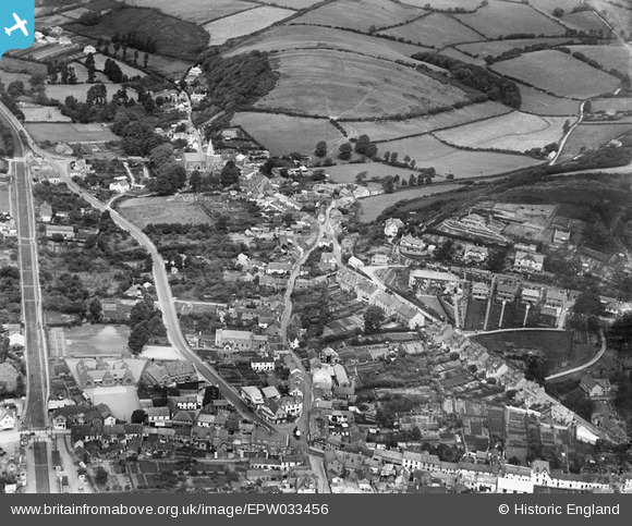
EPW033456 ENGLAND (1930). The village centre, St Brannock's Church and Chapel Hill, Braunton, 1930
© Copyright OpenStreetMap contributors and licensed by the OpenStreetMap Foundation. 2026. Cartography is licensed as CC BY-SA.
Nearby Images (5)
EPW033456

EPW033457

EPW033455

EPW033459

EPW033454

Details
| Title | [EPW033456] The village centre, St Brannock's Church and Chapel Hill, Braunton, 1930 |
| Reference | EPW033456 |
| Date | July-1930 |
| Link | |
| Place name | BRAUNTON |
| Parish | BRAUNTON |
| District | |
| Country | ENGLAND |
| Easting / Northing | 248925, 136823 |
| Longitude / Latitude | -4.1584304055202, 51.110234736528 |
| National Grid Reference | SS489368 |
Pins

jandpatupton |
Monday 6th of October 2014 03:13:20 PM | |
|
Bary H |
Monday 30th of September 2013 08:05:08 PM | |
|
MB |
Tuesday 2nd of April 2013 06:12:27 PM | |
|
MB |
Tuesday 2nd of April 2013 06:11:22 PM | |
|
MB |
Tuesday 2nd of April 2013 06:07:26 PM |