
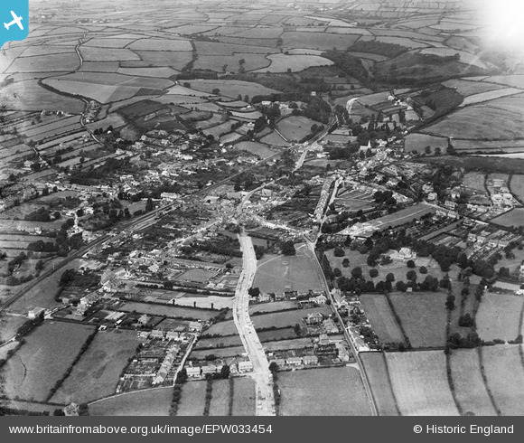
EPW033454 ENGLAND (1930). The village and surrounding countryside, Braunton, 1930
© Copyright OpenStreetMap contributors and licensed by the OpenStreetMap Foundation. 2026. Cartography is licensed as CC BY-SA.
Nearby Images (5)
EPW033454

EPW033459

EPW033455

EPW033458

EPW033456

Details
| Title | [EPW033454] The village and surrounding countryside, Braunton, 1930 |
| Reference | EPW033454 |
| Date | July-1930 |
| Link | |
| Place name | BRAUNTON |
| Parish | BRAUNTON |
| District | |
| Country | ENGLAND |
| Easting / Northing | 248837, 136588 |
| Longitude / Latitude | -4.1595882467724, 51.10809965221 |
| National Grid Reference | SS488366 |
Pins

Clare |
Tuesday 21st of March 2023 06:28:50 PM | |
Allen T |
Thursday 6th of June 2013 05:24:43 PM | |
Allen T |
Thursday 6th of June 2013 05:24:03 PM | |
Allen T |
Thursday 6th of June 2013 05:22:30 PM | |
Allen T |
Thursday 6th of June 2013 05:21:30 PM | |
Allen T |
Thursday 6th of June 2013 05:20:15 PM | |
Allen T |
Thursday 6th of June 2013 05:10:34 PM | |
Allen T |
Thursday 6th of June 2013 05:10:12 PM | |
Allen T |
Thursday 6th of June 2013 05:06:34 PM | |
|
Geoff |
Tuesday 2nd of April 2013 06:03:07 PM |