
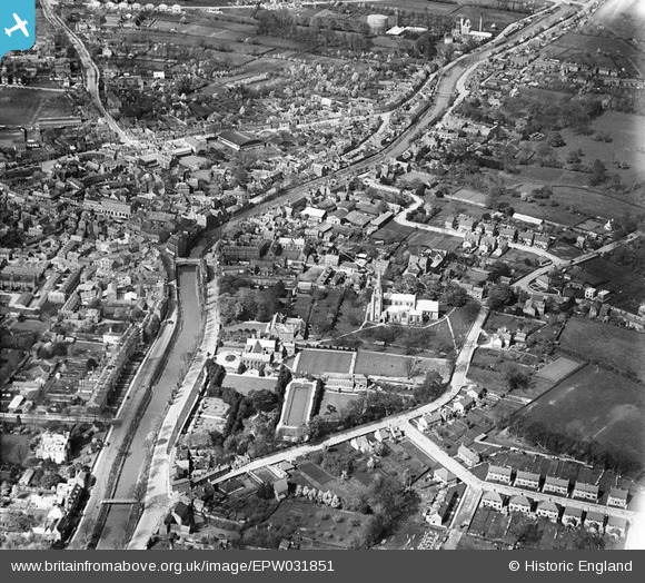
EPW031851 ENGLAND (1930). St Mary and St Nicholas's Church, the River Welland and the town centre, Spalding, 1930
© Copyright OpenStreetMap contributors and licensed by the OpenStreetMap Foundation. 2026. Cartography is licensed as CC BY-SA.
Nearby Images (2)
EPW031851

EPW031858

Details
| Title | [EPW031851] St Mary and St Nicholas's Church, the River Welland and the town centre, Spalding, 1930 |
| Reference | EPW031851 |
| Date | 7-May-1930 |
| Link | |
| Place name | SPALDING |
| Parish | |
| District | |
| Country | ENGLAND |
| Easting / Northing | 524961, 322489 |
| Longitude / Latitude | -0.14689712105317, 52.785157888675 |
| National Grid Reference | TF250225 |
Pins
Be the first to add a comment to this image!