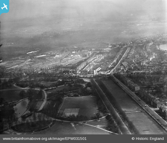
EPW031501 ENGLAND (1930). Finsbury Park, Woodberry Grove and environs, Finsbury Park, from the south-west, 1930
© Copyright OpenStreetMap contributors and licensed by the OpenStreetMap Foundation. 2026. Cartography is licensed as CC BY-SA.
Nearby Images (6)
Details
| Title | [EPW031501] Finsbury Park, Woodberry Grove and environs, Finsbury Park, from the south-west, 1930 |
| Reference | EPW031501 |
| Date | February-1930 |
| Link | |
| Place name | FINSBURY PARK |
| Parish | |
| District | |
| Country | ENGLAND |
| Easting / Northing | 531809, 187370 |
| Longitude / Latitude | -0.097936110120324, 51.569298833543 |
| National Grid Reference | TQ318874 |
Pins

John Wass |
Monday 14th of July 2014 05:07:24 PM |


![[EPW031501] Finsbury Park, Woodberry Grove and environs, Finsbury Park, from the south-west, 1930](http://britainfromabove.org.uk/sites/all/libraries/aerofilms-images/public/100x100/EPW/031/EPW031501.jpg)
![[EPW031504] Finsbury Park, Woodberry Grove and Harringay Stadium, Finsbury Park, from the south-west, 1930](http://britainfromabove.org.uk/sites/all/libraries/aerofilms-images/public/100x100/EPW/031/EPW031504.jpg)
![[EPW031660] Finsbury Park and Seven Sisters Road, Finsbury Park, from the south-west, 1930](http://britainfromabove.org.uk/sites/all/libraries/aerofilms-images/public/100x100/EPW/031/EPW031660.jpg)
![[EPW031663] Finsbury Park and Seven Sisters Road, Finsbury Park, from the south-west, 1930](http://britainfromabove.org.uk/sites/all/libraries/aerofilms-images/public/100x100/EPW/031/EPW031663.jpg)
![[EPW031665] Finsbury Park and Seven Sisters Road, Finsbury Park, from the south-west, 1930](http://britainfromabove.org.uk/sites/all/libraries/aerofilms-images/public/100x100/EPW/031/EPW031665.jpg)
![[EPW031664] Finsbury Park and the East and West Reservoirs, Finsbury Park, from the north-west, 1930](http://britainfromabove.org.uk/sites/all/libraries/aerofilms-images/public/100x100/EPW/031/EPW031664.jpg)