
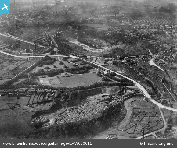
EPW030011 ENGLAND (1929). Queen's Park and environs, Burnley, 1929
© Copyright OpenStreetMap contributors and licensed by the OpenStreetMap Foundation. 2026. Cartography is licensed as CC BY-SA.
Nearby Images (9)
EPW030011

EPW030012

EPW030008

EPW030009

EAW037573

EAW037569

EAW037570

EPW030010

EAW037571

Details
| Title | [EPW030011] Queen's Park and environs, Burnley, 1929 |
| Reference | EPW030011 |
| Date | October-1929 |
| Link | |
| Place name | BURNLEY |
| Parish | |
| District | |
| Country | ENGLAND |
| Easting / Northing | 384862, 433380 |
| Longitude / Latitude | -2.2298416322289, 53.796292601719 |
| National Grid Reference | SD849334 |
Pins
Be the first to add a comment to this image!