
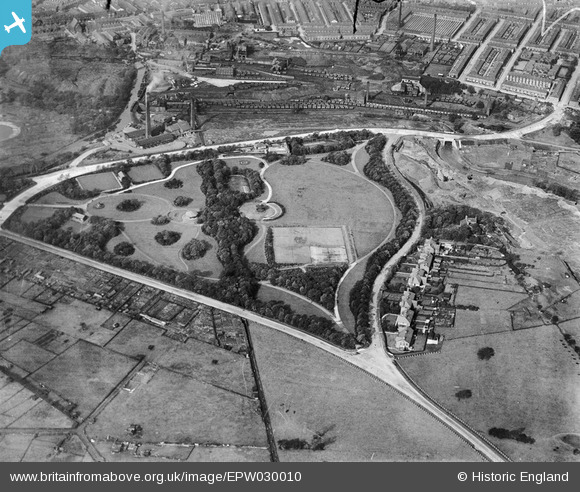
EPW030010 ENGLAND (1929). Queen's Park and environs, Burnley, 1929
© Copyright OpenStreetMap contributors and licensed by the OpenStreetMap Foundation. 2026. Cartography is licensed as CC BY-SA.
Nearby Images (5)
EPW030010

EPW030009

EPW030011

EPW030008

EPW030012

Details
| Title | [EPW030010] Queen's Park and environs, Burnley, 1929 |
| Reference | EPW030010 |
| Date | October-1929 |
| Link | |
| Place name | BURNLEY |
| Parish | |
| District | |
| Country | ENGLAND |
| Easting / Northing | 385007, 433310 |
| Longitude / Latitude | -2.227636695988, 53.795667574427 |
| National Grid Reference | SD850333 |
Pins
Be the first to add a comment to this image!