
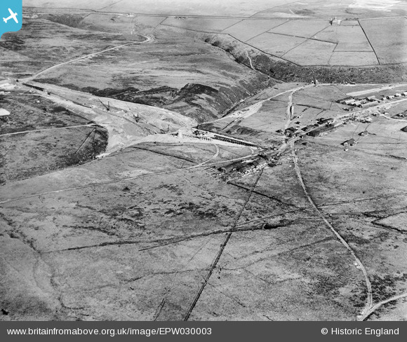
EPW030003 ENGLAND (1929). Gorple Lower Reservoir under construction, Black Moor, 1929
© Copyright OpenStreetMap contributors and licensed by the OpenStreetMap Foundation. 2026. Cartography is licensed as CC BY-SA.
Nearby Images (6)
EPW030003

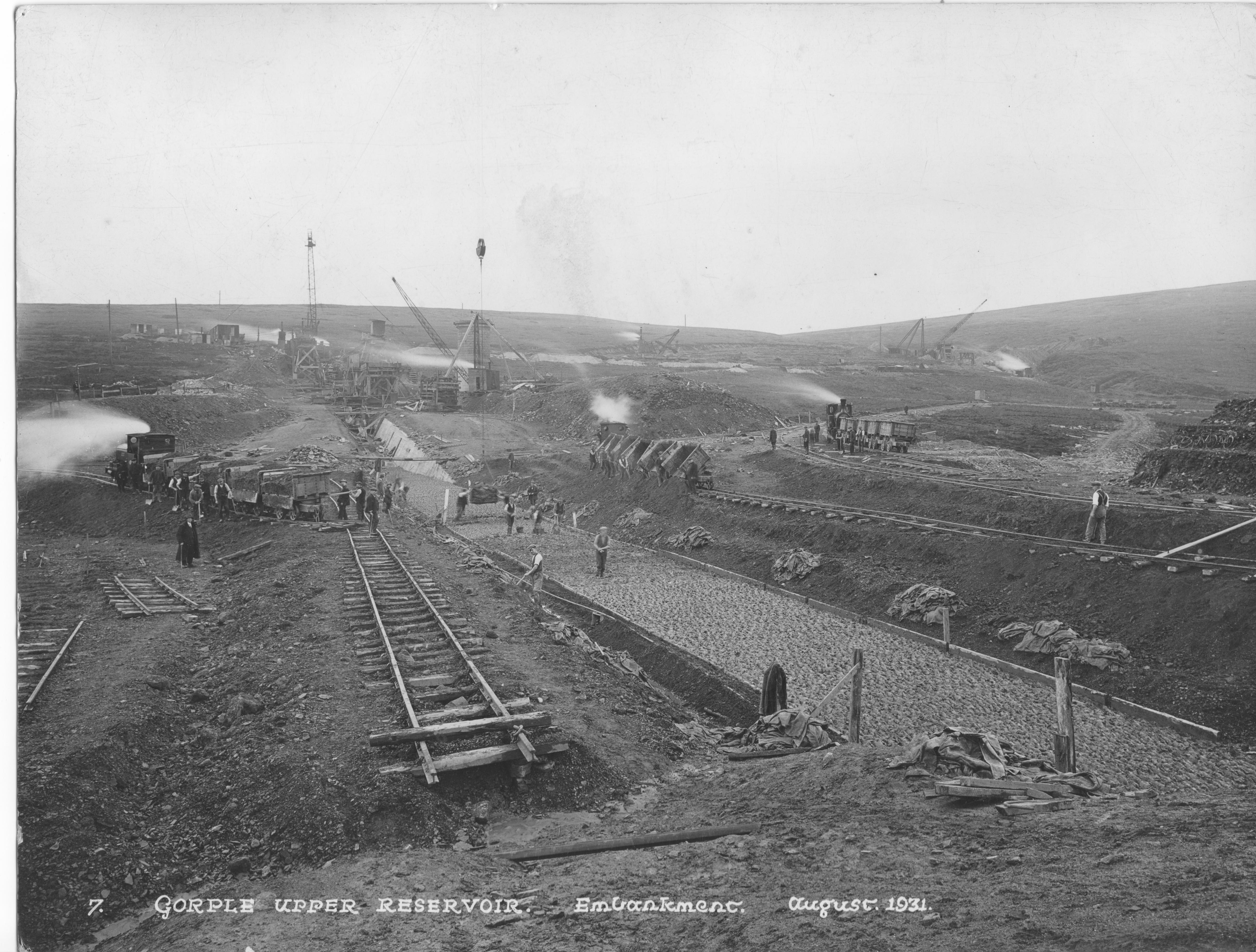
EPW030007

EPW029996

EPW030004

EPW030006

EPW029998

Details
| Title | [EPW030003] Gorple Lower Reservoir under construction, Black Moor, 1929 |
| Reference | EPW030003 |
| Date | October-1929 |
| Link | |
| Place name | BLACK MOOR |
| Parish | HEPTONSTALL |
| District | |
| Country | ENGLAND |
| Easting / Northing | 394312, 431262 |
| Longitude / Latitude | -2.0863226601144, 53.777443001338 |
| National Grid Reference | SD943313 |
Pins
Be the first to add a comment to this image!
User Comment Contributions
This top of this image shows the Packhorse Inn on the road at the right. Go left along the road and you come to two rather indistinct houses next to each other in the corner of a field. These were temporary wood built homes provided by the contractor. My paternal grandfather, as Inspector of masonry, was allocated one of these and my father and uncle grew up there. They remembered the fierce winters. There is no sign now that they ever existed and this is the only , albeit distant, record of their existence. As has been noted the unallocated images are all of the upper reservoir.My family are in possession of some high quality images of the construction (taken by Stewart Bale a professional industrial photographer based in Liverpool) and a brochure of the opening ceremony. I have sent an image to the landlord of the Packhorse. |

wef |
Tuesday 13th of November 2012 02:57:42 PM |