
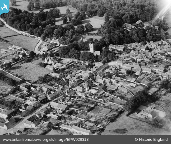
EPW029318 ENGLAND (1929). St Michael's Church and the High Street, Lambourn, 1929
© Copyright OpenStreetMap contributors and licensed by the OpenStreetMap Foundation. 2026. Cartography is licensed as CC BY-SA.
Nearby Images (13)
EPW029318

EPW029320

EAW023190

EAW023189

EAW023194

EAW023188

EAW023193

EAW023192

EPW029317

EAW023191

EPW029319

EPW029316

EPW029315

Details
| Title | [EPW029318] St Michael's Church and the High Street, Lambourn, 1929 |
| Reference | EPW029318 |
| Date | September-1929 |
| Link | |
| Place name | LAMBOURN |
| Parish | LAMBOURN |
| District | |
| Country | ENGLAND |
| Easting / Northing | 432597, 178899 |
| Longitude / Latitude | -1.5302644324481, 51.507597777314 |
| National Grid Reference | SU326789 |
Pins
Be the first to add a comment to this image!