
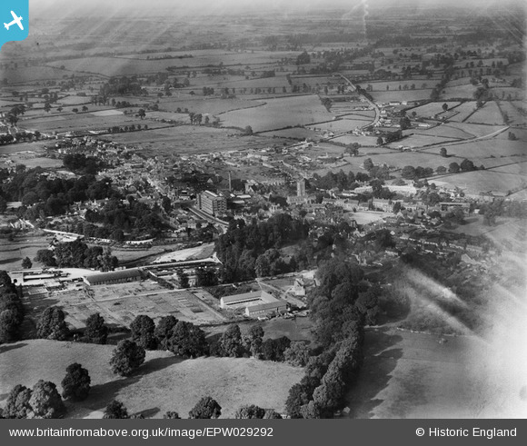
EPW029292 ENGLAND (1929). The town, Calne, from the south, 1929
© Copyright OpenStreetMap contributors and licensed by the OpenStreetMap Foundation. 2026. Cartography is licensed as CC BY-SA.
Nearby Images (9)
EPW029292

EPR000054

EPR000051

EPR000052

EPR000050

EPR000055

EPR000049
 Ltd By-Products Factory at the railway station, Calne, 1934")
EPR000053

EPW029301

Details
| Title | [EPW029292] The town, Calne, from the south, 1929 |
| Reference | EPW029292 |
| Date | 14-September-1929 |
| Link | |
| Place name | CALNE |
| Parish | CALNE |
| District | |
| Country | ENGLAND |
| Easting / Northing | 399741, 170479 |
| Longitude / Latitude | -2.0037261860213, 51.432820917001 |
| National Grid Reference | ST997705 |
Pins

MB |
Monday 3rd of June 2013 10:41:29 PM |