
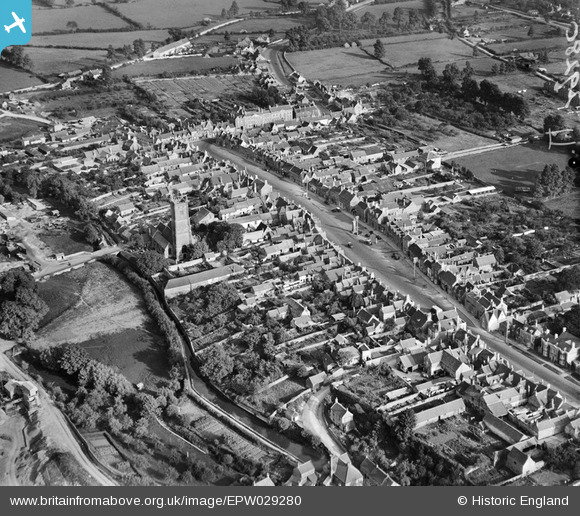
EPW029280 ENGLAND (1929). The town centre, Chipping Sodbury, 1929
© Copyright OpenStreetMap contributors and licensed by the OpenStreetMap Foundation. 2026. Cartography is licensed as CC BY-SA.
Nearby Images (11)
EPW029280

EPW029279

EPW029278

EPW024114

EAW020915

EPW029281

EAW020916

EAW020914

EPW024115

EPW024128

EPW029286

Details
| Title | [EPW029280] The town centre, Chipping Sodbury, 1929 |
| Reference | EPW029280 |
| Date | September-1929 |
| Link | |
| Place name | CHIPPING SODBURY |
| Parish | SODBURY |
| District | |
| Country | ENGLAND |
| Easting / Northing | 372705, 182247 |
| Longitude / Latitude | -2.3935932487939, 51.537984923025 |
| National Grid Reference | ST727822 |
Pins

LewisD |
Monday 29th of April 2019 03:31:39 PM | |
|
LewisD |
Monday 29th of April 2019 03:23:04 PM | |
|
freestyle |
Friday 10th of April 2015 03:26:23 PM | |
|
freestyle |
Friday 10th of April 2015 03:25:24 PM | |
This is the Mill Pond |
LewisD |
Monday 29th of April 2019 03:23:38 PM |