
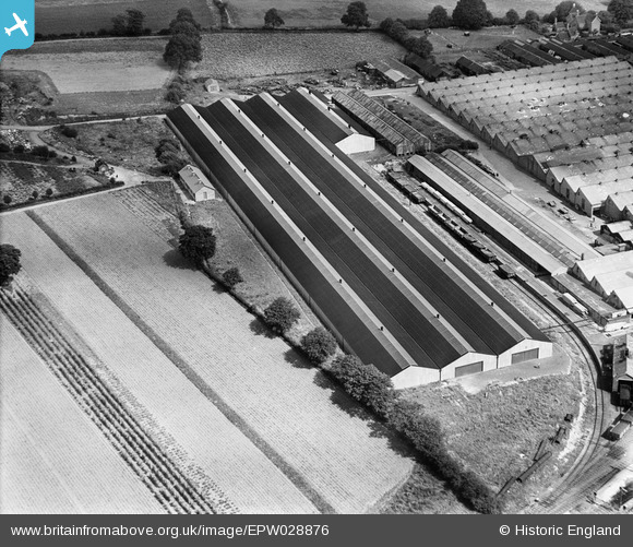
EPW028876 ENGLAND (1929). The Longbridge Motor Works, Longbridge, 1929
© Copyright OpenStreetMap contributors and licensed by the OpenStreetMap Foundation. 2026. Cartography is licensed as CC BY-SA.
Nearby Images (21)
EPW028876

EPW028874

EPW024834

EPW028875

EPW026898

EPW024822

EPW026902

EPW026896

EPW026903

EPW024824

EPW024823

EPW047796

EPW047795

EPW047798

EPW047792

EPW047786

EPW024831

EPW047802

EPW047785

EPW047789

EPW047793

Details
| Title | [EPW028876] The Longbridge Motor Works, Longbridge, 1929 |
| Reference | EPW028876 |
| Date | August-1929 |
| Link | |
| Place name | LONGBRIDGE |
| Parish | |
| District | |
| Country | ENGLAND |
| Easting / Northing | 400696, 277738 |
| Longitude / Latitude | -1.9897699148554, 52.397279620651 |
| National Grid Reference | SP007777 |
Pins
User Comment Contributions
EPW028874/75/76, all marked "unlocated" are all clearly the same location as EPW026898: simply look at the details side by side. The map alongside them already indicates the location so why are they marked "unlocated" ? |

Windyridge |
Monday 12th of November 2012 10:49:47 AM |
Longbridge works . Nazareth house top right in picture. |
Paul |
Friday 2nd of November 2012 10:47:05 AM |
See EPW026903 etc |

Dylan Moore |
Monday 29th of October 2012 11:04:33 PM |
This looks like the Longbridge Motor Works. See image EPW026898 |
Dougal the Dog |
Sunday 21st of October 2012 09:55:07 AM |