
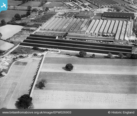
EPW026903 ENGLAND (1929). Longbridge Motor Works, Longbridge, 1929
© Copyright OpenStreetMap contributors and licensed by the OpenStreetMap Foundation. 2026. Cartography is licensed as CC BY-SA.
Nearby Images (21)
EPW026903

EPW026902

EPW026896

EPW047796

EPW028876

EPW028874

EPW024822

EPW028875

EPW026898

EPW024834

EPW024823

EPW047795

EPW047786

EPW024824

EPW024831

EPW047792

EPW047798

EPW047785

EPW047802

EPW047789

EPW047793

Details
| Title | [EPW026903] Longbridge Motor Works, Longbridge, 1929 |
| Reference | EPW026903 |
| Date | May-1929 |
| Link | |
| Place name | LONGBRIDGE |
| Parish | |
| District | |
| Country | ENGLAND |
| Easting / Northing | 400682, 277774 |
| Longitude / Latitude | -1.9899756190807, 52.397603319077 |
| National Grid Reference | SP007778 |
Pins
Be the first to add a comment to this image!