
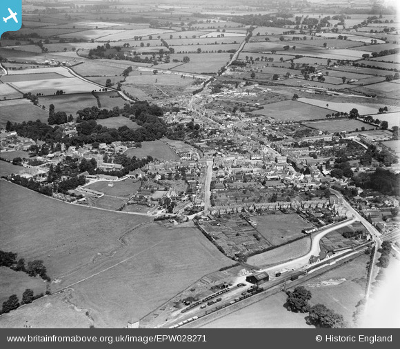
EPW028271 ENGLAND (1929). The town, Bicester, from the south, 1929
© Copyright OpenStreetMap contributors and licensed by the OpenStreetMap Foundation. 2026. Cartography is licensed as CC BY-SA.
Nearby Images (3)
EPW028271

EPW028272

EPW028268

Details
| Title | [EPW028271] The town, Bicester, from the south, 1929 |
| Reference | EPW028271 |
| Date | August-1929 |
| Link | |
| Place name | BICESTER |
| Parish | BICESTER |
| District | |
| Country | ENGLAND |
| Easting / Northing | 458515, 222003 |
| Longitude / Latitude | -1.1495752137074, 51.893065248906 |
| National Grid Reference | SP585220 |
