
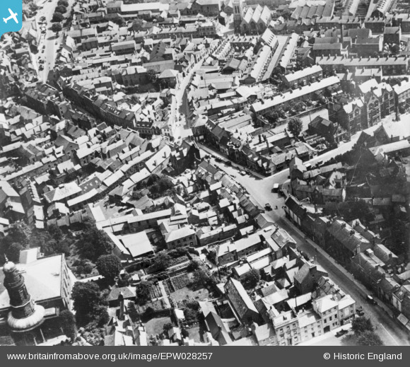
EPW028257 ENGLAND (1929). High Street, Banbury, 1929. This image has been produced from a copy-negative.
© Copyright OpenStreetMap contributors and licensed by the OpenStreetMap Foundation. 2026. Cartography is licensed as CC BY-SA.
Nearby Images (23)
EPW028257

EPW010584

EAW006317

EAW006315

EAW006320

EAW006316

EAW006321

EPW028252

EAW006311

EAW006319

EAW029563

EAW006318

EPW028256

EAW006314

EAW006322

EAW029564

EPW006004

EAW006313

EPW028258

EPW028255

EPW028259

EPW028260

EAW029565

Details
| Title | [EPW028257] High Street, Banbury, 1929. This image has been produced from a copy-negative. |
| Reference | EPW028257 |
| Date | August-1929 |
| Link | |
| Place name | BANBURY |
| Parish | BANBURY |
| District | |
| Country | ENGLAND |
| Easting / Northing | 445506, 240488 |
| Longitude / Latitude | -1.3361733294345, 52.060481386652 |
| National Grid Reference | SP455405 |
Pins
Be the first to add a comment to this image!