
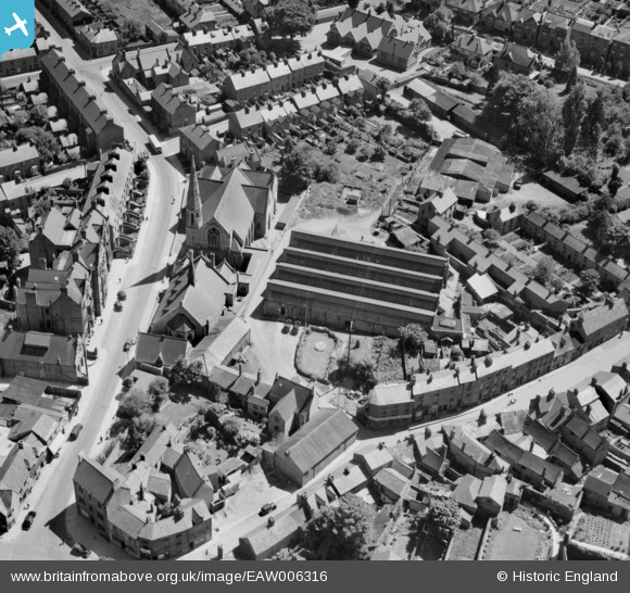
EAW006316 ENGLAND (1947). Cheney & Sons Ltd on Calthorpe Street and environs, Banbury, 1947
© Copyright OpenStreetMap contributors and licensed by the OpenStreetMap Foundation. 2026. Cartography is licensed as CC BY-SA.
Nearby Images (28)
EAW006316

EAW006321

EAW006320

EAW006317

EAW006319

EAW006318

EAW006315

EPW028257

EAW029563

EAW006322

EPW028252

EPW006004

EAW006314

EAW029564

EPW028256

EPW028260

EPW010584

EPW028255

EAW006311

EPW028261

EAW006313

EAW029562
 Ltd Surgical Appliance Factory, Banbury, 1950. This image was marked by Aerofilms Ltd for photo editing.")
EAW029556
 Ltd Surgical Appliance Factory, Banbury, 1950. This image was marked by Aerofilms Ltd for photo editing.")
EAW029561
 Ltd Surgical Appliance Factory, Banbury, 1950. This image was marked by Aerofilms Ltd for photo editing.")
EAW029557
 Ltd Surgical Appliance Factory, Banbury, 1950. This image was marked by Aerofilms Ltd for photo editing.")
EAW029559
 Ltd Surgical Appliance Factory, Banbury, 1950. This image was marked by Aerofilms Ltd for photo editing.")
EAW029560
 Ltd Surgical Appliance Factory, Banbury, 1950. This image was marked by Aerofilms Ltd for photo editing.")
EAW029558
 Ltd Surgical Appliance Factory and environs, Banbury, 1950. This image was marked by Aerofilms Ltd for photo editing.")
Details
| Title | [EAW006316] Cheney & Sons Ltd on Calthorpe Street and environs, Banbury, 1947 |
| Reference | EAW006316 |
| Date | 27-May-1947 |
| Link | |
| Place name | BANBURY |
| Parish | BANBURY |
| District | |
| Country | ENGLAND |
| Easting / Northing | 445491, 240348 |
| Longitude / Latitude | -1.3364107823533, 52.05922387249 |
| National Grid Reference | SP455403 |
Pins
Be the first to add a comment to this image!