
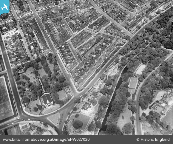
EPW027020 ENGLAND (1929). North Gate, St John the Baptist's Church and environs, St John's Wood, 1929
© Copyright OpenStreetMap contributors and licensed by the OpenStreetMap Foundation. 2026. Cartography is licensed as CC BY-SA.
Nearby Images (13)
EPW027020

EPW027019

EPW027022

EPW027024

EPW027023

EPW027021

EPW027026

EPW027018

EPW027025

EAW018354

EAW044240

EPW005641

EAW018355

Details
| Title | [EPW027020] North Gate, St John the Baptist's Church and environs, St John's Wood, 1929 |
| Reference | EPW027020 |
| Date | May-1929 |
| Link | |
| Place name | ST JOHN'S WOOD |
| Parish | |
| District | |
| Country | ENGLAND |
| Easting / Northing | 527219, 183001 |
| Longitude / Latitude | -0.16571506799065, 51.531085599911 |
| National Grid Reference | TQ272830 |
Pins

FramptonStreetBoy |
Saturday 11th of February 2023 08:42:59 PM | |
|
ray Glenister |
Friday 13th of December 2019 02:41:27 AM | |
|
ray Glenister |
Friday 13th of December 2019 02:41:26 AM | |
|
Captaintee |
Thursday 24th of July 2014 01:47:02 PM | |
|
Captaintee |
Thursday 24th of July 2014 01:46:19 PM | |
|
mack22 |
Sunday 3rd of March 2013 05:50:14 PM |