
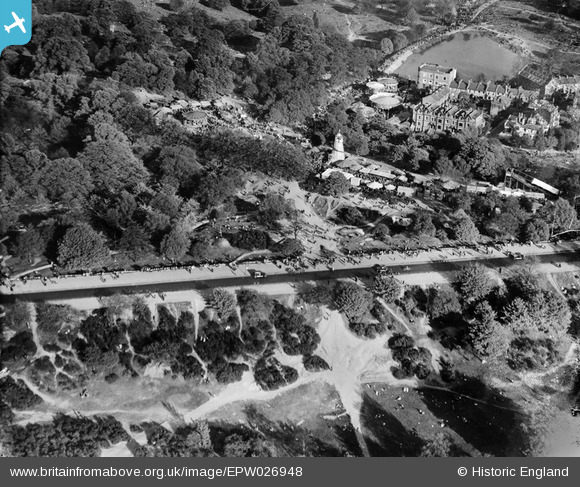
EPW026948 ENGLAND (1929). Spaniard's Road and funfair on Hampstead Heath, Hampstead, 1929
© Copyright OpenStreetMap contributors and licensed by the OpenStreetMap Foundation. 2026. Cartography is licensed as CC BY-SA.
Nearby Images (7)
EPW026948

EPW028171

EPW005126

EPW000815

EPW016652

EPW005118

EPW000430

Details
| Title | [EPW026948] Spaniard's Road and funfair on Hampstead Heath, Hampstead, 1929 |
| Reference | EPW026948 |
| Date | May-1929 |
| Link | |
| Place name | HAMPSTEAD |
| Parish | |
| District | |
| Country | ENGLAND |
| Easting / Northing | 526385, 186717 |
| Longitude / Latitude | -0.17639819564155, 51.564671890301 |
| National Grid Reference | TQ264867 |
Pins

FramptonStreetBoy |
Wednesday 11th of November 2020 07:51:51 PM | |
|
FramptonStreetBoy |
Wednesday 11th of November 2020 07:47:15 PM | |

Class31 |
Wednesday 22nd of October 2014 10:06:53 AM | |
|
Class31 |
Wednesday 22nd of October 2014 09:56:26 AM |


