
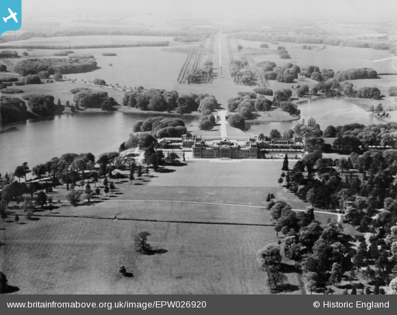
EPW026920 ENGLAND (1929). Blenheim Palace, Woodstock, from the south-east, 1929. This image has been produced from a copy-negative.
© Copyright OpenStreetMap contributors and licensed by the OpenStreetMap Foundation. 2026. Cartography is licensed as CC BY-SA.
Nearby Images (3)
EPW026920

EAW041214

EAW014899

Details
| Title | [EPW026920] Blenheim Palace, Woodstock, from the south-east, 1929. This image has been produced from a copy-negative. |
| Reference | EPW026920 |
| Date | May-1929 |
| Link | |
| Place name | WOODSTOCK |
| Parish | BLENHEIM |
| District | |
| Country | ENGLAND |
| Easting / Northing | 444266, 215742 |
| Longitude / Latitude | -1.3574486303562, 51.838084422026 |
| National Grid Reference | SP443157 |
Pins
Be the first to add a comment to this image!