
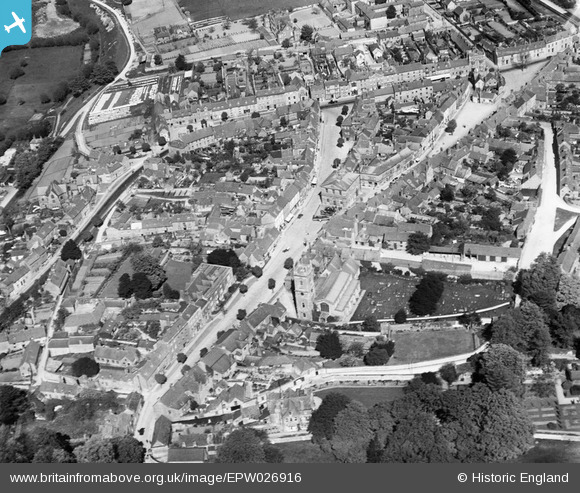
EPW026916 ENGLAND (1929). St Mary's Church and the town centre, Woodstock, 1929
© Copyright OpenStreetMap contributors and licensed by the OpenStreetMap Foundation. 2026. Cartography is licensed as CC BY-SA.
Nearby Images (8)
EPW026916

EPW026922

EPW026918

EPW026917

EPW026919

EAW014902

EPW026915

EPW026921

Details
| Title | [EPW026916] St Mary's Church and the town centre, Woodstock, 1929 |
| Reference | EPW026916 |
| Date | May-1929 |
| Link | |
| Place name | WOODSTOCK |
| Parish | WOODSTOCK |
| District | |
| Country | ENGLAND |
| Easting / Northing | 444437, 216755 |
| Longitude / Latitude | -1.3548364266611, 51.84717913699 |
| National Grid Reference | SP444168 |
Pins

Matthew Kilburn |
Saturday 28th of June 2014 02:45:24 PM |