
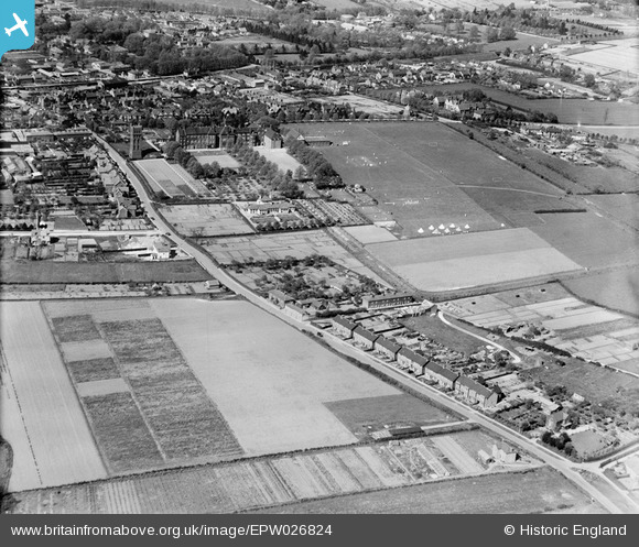
EPW026824 ENGLAND (1929). Debden Road and the Friends' School, Saffron Walden, 1929
© Copyright OpenStreetMap contributors and licensed by the OpenStreetMap Foundation. 2026. Cartography is licensed as CC BY-SA.
Nearby Images (13)
EPW026824

EPW026829

EPW026823

EPW026827

EPW026817

EPW026833

EPW026830

EPW026831

EPW026821

EPW025914

EPW026834

EPW026819

EPW026822

Details
| Title | [EPW026824] Debden Road and the Friends' School, Saffron Walden, 1929 |
| Reference | EPW026824 |
| Date | May-1929 |
| Link | |
| Place name | SAFFRON WALDEN |
| Parish | SAFFRON WALDEN |
| District | |
| Country | ENGLAND |
| Easting / Northing | 553949, 237428 |
| Longitude / Latitude | 0.24352974513419, 52.013471070401 |
| National Grid Reference | TL539374 |
Pins
Be the first to add a comment to this image!