
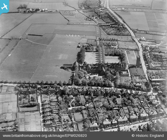
EPW026820 ENGLAND (1929). The Friends' School and environs, Saffron Walden, 1929
© Copyright OpenStreetMap contributors and licensed by the OpenStreetMap Foundation. 2026. Cartography is licensed as CC BY-SA.
Nearby Images (17)
EPW026820

EPW026828

EPW025914

EPW026821

EPW026826

EPW026832

EPW026830

EPW026835

EPW026819

EPW026836

EPW026817

EPW026833

EPW026818

EPW026822

EPW026829

EPW026827

EPW026831

Details
| Title | [EPW026820] The Friends' School and environs, Saffron Walden, 1929 |
| Reference | EPW026820 |
| Date | May-1929 |
| Link | |
| Place name | SAFFRON WALDEN |
| Parish | SAFFRON WALDEN |
| District | |
| Country | ENGLAND |
| Easting / Northing | 554012, 237683 |
| Longitude / Latitude | 0.24456180091495, 52.015744716065 |
| National Grid Reference | TL540377 |
Pins
Be the first to add a comment to this image!