
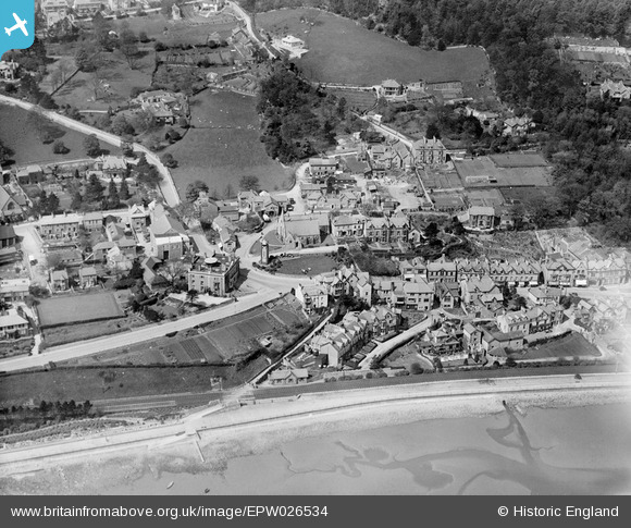
EPW026534 ENGLAND (1929). The Clock Tower and environs, Grange-Over-Sands, 1929
© Copyright OpenStreetMap contributors and licensed by the OpenStreetMap Foundation. 2026. Cartography is licensed as CC BY-SA.
Nearby Images (2)
EPW026534

EPW026528

Details
| Title | [EPW026534] The Clock Tower and environs, Grange-Over-Sands, 1929 |
| Reference | EPW026534 |
| Date | May-1929 |
| Link | |
| Place name | GRANGE-OVER-SANDS |
| Parish | GRANGE-OVER-SANDS |
| District | |
| Country | ENGLAND |
| Easting / Northing | 340747, 477882 |
| Longitude / Latitude | -2.9082500585045, 54.193105069702 |
| National Grid Reference | SD407779 |
Pins

stewpot |
Tuesday 25th of August 2020 08:34:28 AM | |
|
oversands |
Tuesday 11th of December 2012 05:41:36 PM | |
|
oversands |
Tuesday 11th of December 2012 05:41:11 PM |