
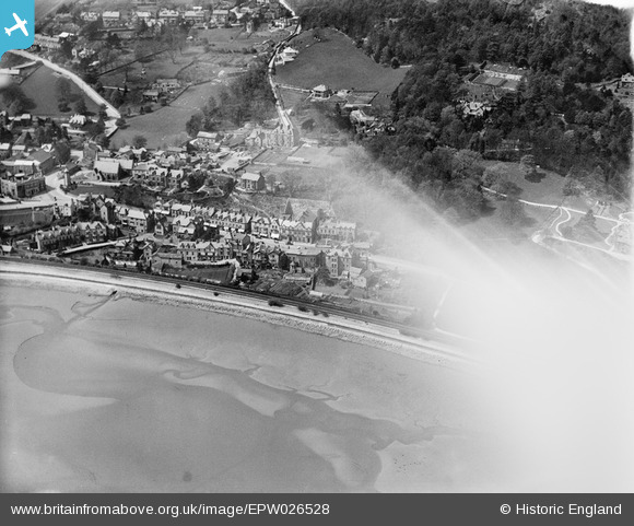
EPW026528 ENGLAND (1929). Main Street and environs, Grange-Over-Sands, 1929. This image has been affected by flare.
© Copyright OpenStreetMap contributors and licensed by the OpenStreetMap Foundation. 2026. Cartography is licensed as CC BY-SA.
Nearby Images (3)
EPW026528

EPW026534

EPW026533

Details
| Title | [EPW026528] Main Street and environs, Grange-Over-Sands, 1929. This image has been affected by flare. |
| Reference | EPW026528 |
| Date | May-1929 |
| Link | |
| Place name | GRANGE-OVER-SANDS |
| Parish | GRANGE-OVER-SANDS |
| District | |
| Country | ENGLAND |
| Easting / Northing | 340867, 477991 |
| Longitude / Latitude | -2.9064323479551, 54.194098536584 |
| National Grid Reference | SD409780 |
Pins
Be the first to add a comment to this image!