
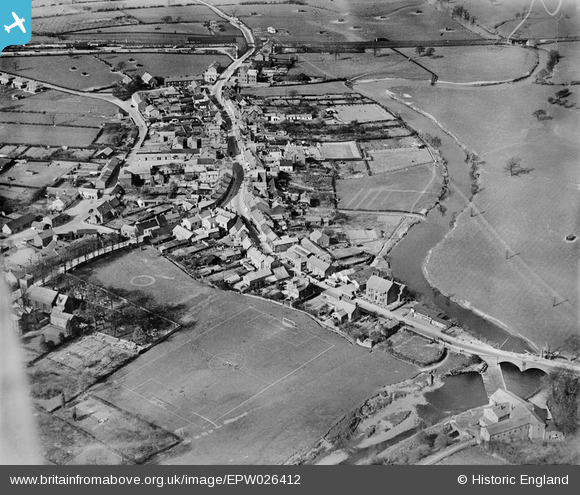
EPW026412 ENGLAND (1929). Garstang Bridge and the town, Garstang, 1929
© Copyright OpenStreetMap contributors and licensed by the OpenStreetMap Foundation. 2026. Cartography is licensed as CC BY-SA.
Nearby Images (5)
EPW026412

EPW026415

EPW026414

EPW026411

EPW026410

Details
| Title | [EPW026412] Garstang Bridge and the town, Garstang, 1929 |
| Reference | EPW026412 |
| Date | April-1929 |
| Link | |
| Place name | GARSTANG |
| Parish | GARSTANG |
| District | |
| Country | ENGLAND |
| Easting / Northing | 349234, 445112 |
| Longitude / Latitude | -2.7726893087613, 53.899484790367 |
| National Grid Reference | SD492451 |
Pins

wadey |
Tuesday 7th of October 2014 02:01:05 PM | |
|
wadey |
Tuesday 7th of October 2014 02:00:05 PM | |
|
wadey |
Tuesday 7th of October 2014 01:58:00 PM | |
|
wadey |
Tuesday 7th of October 2014 01:57:40 PM | |
|
wadey |
Tuesday 7th of October 2014 01:56:27 PM | |
|
wadey |
Tuesday 7th of October 2014 01:54:48 PM | |
|
Rob Daniels |
Wednesday 19th of February 2014 09:31:59 AM | |
That should be G&KER, of course! |
Rob Daniels |
Wednesday 19th of February 2014 09:46:18 AM |
|
Rob Daniels |
Wednesday 19th of February 2014 09:10:20 AM | |
|
Rob Daniels |
Wednesday 19th of February 2014 09:02:53 AM |
User Comment Contributions

The locomotive that I believe is in the photo. |
Rob Daniels |
Wednesday 19th of February 2014 10:09:05 AM |