
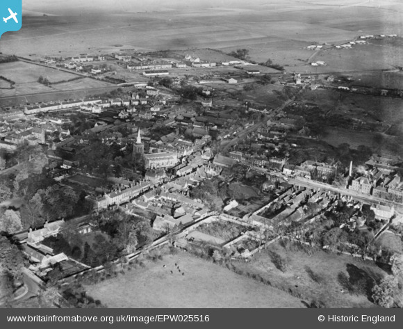
EPW025516 ENGLAND (1928). The town, Baldock, 1928. This image has been produced from a copy-negative.
© Copyright OpenStreetMap contributors and licensed by the OpenStreetMap Foundation. 2026. Cartography is licensed as CC BY-SA.
Nearby Images (6)
EPW025516

EPW013415

EPW025515

EPW013413

EPW013412

EPW013414

Details
| Title | [EPW025516] The town, Baldock, 1928. This image has been produced from a copy-negative. |
| Reference | EPW025516 |
| Date | 14-November-1928 |
| Link | |
| Place name | BALDOCK |
| Parish | |
| District | |
| Country | ENGLAND |
| Easting / Northing | 524452, 233912 |
| Longitude / Latitude | -0.18735283008813, 51.989272585084 |
| National Grid Reference | TL245339 |
Pins

Hugh Madgin |
Wednesday 12th of November 2014 05:26:57 PM | |
They would be on the station built by the now ex Great Northern Railway's Hitchin to Shepreth branch and on to Cambridge. Traffic was expanding by this time. |
John Wass |
Wednesday 11th of January 2017 02:40:39 PM |