
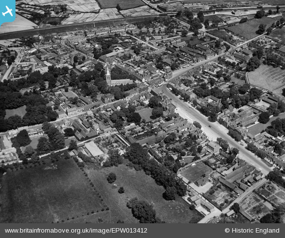
EPW013412 ENGLAND (1925). The town centre, Baldock, 1925
© Copyright OpenStreetMap contributors and licensed by the OpenStreetMap Foundation. 2026. Cartography is licensed as CC BY-SA.
Nearby Images (6)
EPW013412

EPW025516

EPW013413

EPW013415

EPW025515

EPW013414

Details
| Title | [EPW013412] The town centre, Baldock, 1925 |
| Reference | EPW013412 |
| Date | June-1925 |
| Link | |
| Place name | BALDOCK |
| Parish | |
| District | |
| Country | ENGLAND |
| Easting / Northing | 524440, 233818 |
| Longitude / Latitude | -0.18756163176912, 51.988430472153 |
| National Grid Reference | TL244338 |
Pins

Kentishman |
Thursday 29th of January 2026 02:46:32 PM | |
|
Kentishman |
Thursday 29th of January 2026 02:43:05 PM | |
|
Stu Giles |
Tuesday 3rd of July 2018 02:54:56 PM | |
|
Chells809 |
Monday 10th of June 2013 10:21:27 PM | |
|
Chells809 |
Monday 10th of June 2013 10:19:54 PM |