
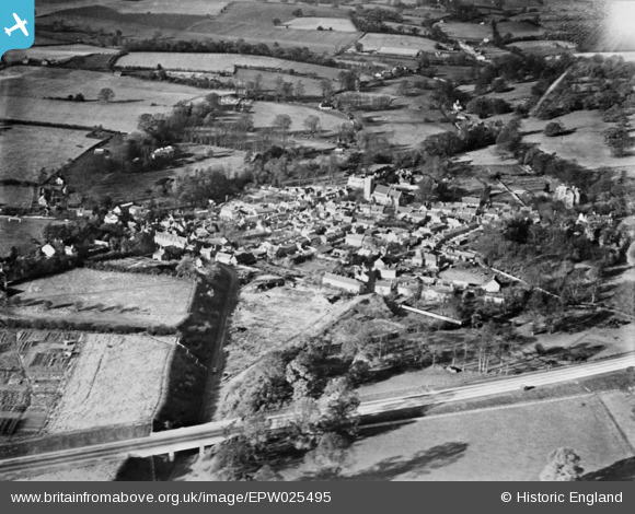
EPW025495 ENGLAND (1928). The village, Welwyn, 1928. This image has been produced from a copy-negative.
© Copyright OpenStreetMap contributors and licensed by the OpenStreetMap Foundation. 2026. Cartography is licensed as CC BY-SA.
Nearby Images (4)
EPW025495

EPW025360

EPW025496

EPW025359

Details
| Title | [EPW025495] The village, Welwyn, 1928. This image has been produced from a copy-negative. |
| Reference | EPW025495 |
| Date | 14-November-1928 |
| Link | |
| Place name | WELWYN |
| Parish | WELWYN |
| District | |
| Country | ENGLAND |
| Easting / Northing | 523146, 216133 |
| Longitude / Latitude | -0.21272086313062, 51.829775233236 |
| National Grid Reference | TL231161 |
