
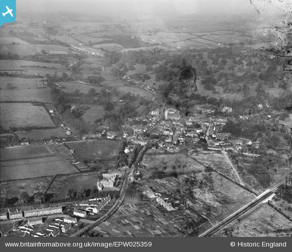
EPW025359 ENGLAND (1928). The village and surrounding countryside, Welwyn, from the south-east, 1928
© Copyright OpenStreetMap contributors and licensed by the OpenStreetMap Foundation. 2026. Cartography is licensed as CC BY-SA.
Nearby Images (3)
EPW025359

EPW025495

EPW025360

Details
| Title | [EPW025359] The village and surrounding countryside, Welwyn, from the south-east, 1928 |
| Reference | EPW025359 |
| Date | November-1928 |
| Link | |
| Place name | WELWYN |
| Parish | WELWYN |
| District | |
| Country | ENGLAND |
| Easting / Northing | 523120, 215950 |
| Longitude / Latitude | -0.21316312104499, 51.828136229741 |
| National Grid Reference | TL231160 |
Pins

Chells809 |
Wednesday 29th of April 2015 09:48:28 PM | |
|
Chells809 |
Wednesday 29th of April 2015 09:47:41 PM | |
|
David960 |
Thursday 5th of February 2015 11:49:08 PM | |
|
Chells809 |
Saturday 18th of May 2013 10:26:46 PM | |
|
Chells809 |
Saturday 18th of May 2013 10:24:18 PM | |
|
Chells809 |
Friday 28th of December 2012 05:17:21 PM | |
|
Chells809 |
Friday 28th of December 2012 05:14:05 PM | |
|
Chells809 |
Friday 9th of November 2012 10:46:31 PM | |
|
Chells809 |
Thursday 8th of November 2012 09:42:11 PM | |
|
Chells809 |
Thursday 8th of November 2012 09:40:19 PM | |
|
Chells809 |
Thursday 8th of November 2012 09:38:52 PM |