
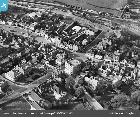
EPW025143 ENGLAND (1928). The High Street and Clock Tower, Epsom, 1928
© Copyright OpenStreetMap contributors and licensed by the OpenStreetMap Foundation. 2026. Cartography is licensed as CC BY-SA.
Nearby Images (21)
EPW025143

EPW025262

EPW025146

EPW048877

EPW057024

EAW024760

EPW048876

EPW025148

EAW024762

EPW057023

EPW006480

EPW006492

EPW006487

EAW043020

EAW043022

EPW048879

EAW043021

EAW043025

EAW043024

EPW006486

EPW007916

Details
| Title | [EPW025143] The High Street and Clock Tower, Epsom, 1928 |
| Reference | EPW025143 |
| Date | October-1928 |
| Link | |
| Place name | EPSOM |
| Parish | |
| District | |
| Country | ENGLAND |
| Easting / Northing | 520809, 160772 |
| Longitude / Latitude | -0.26567357640222, 51.332689142899 |
| National Grid Reference | TQ208608 |
Pins

Pobble |
Friday 22nd of April 2016 04:29:02 PM | |
|
Pobble |
Friday 22nd of April 2016 04:27:21 PM |