
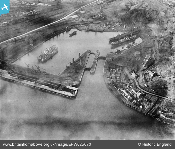
EPW025070 ENGLAND (1928). The Albert Edward Dock, Royal Quays, 1928
© Copyright OpenStreetMap contributors and licensed by the OpenStreetMap Foundation. 2026. Cartography is licensed as CC BY-SA.
Nearby Images (10)
EPW025070

EPW025063

EPW025057

EPW019797

EPW019845

EPW025066

EPW025069

EPW025059

EPW025067

EPW025058

Details
| Title | [EPW025070] The Albert Edward Dock, Royal Quays, 1928 |
| Reference | EPW025070 |
| Date | 14-October-1928 |
| Link | |
| Place name | ROYAL QUAYS |
| Parish | |
| District | |
| Country | ENGLAND |
| Easting / Northing | 435290, 566969 |
| Longitude / Latitude | -1.4483214512381, 54.995975697849 |
| National Grid Reference | NZ353670 |
Pins
Be the first to add a comment to this image!